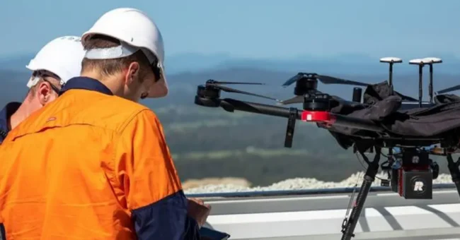
RIEGL manufactures high-performance LiDAR sensors and systems specifically designed for UAS (Unmanned Aerial Vehicles) integration and can strategically adapt the product range for integration into compact multi-rotor and high-speed VTOL…
RIEGL manufactures high-performance LiDAR sensors and systems specifically designed for UAS (Unmanned Aerial Vehicles) integration and can strategically adapt the product range for integration into compact multi-rotor and high-speed VTOL or fixed-wing UAV platforms.
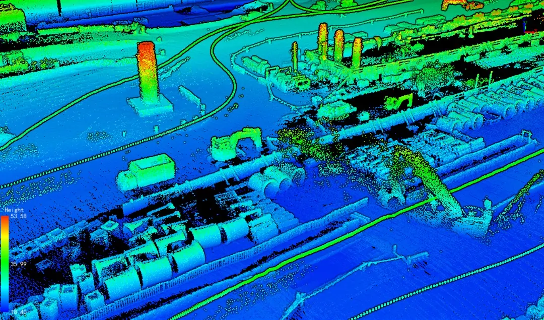
With its new products, RIEGL aims to significantly reduce both the time in the field and the flight time by increasing UAV flights to maximum operating altitudes and the highest area coverage, thus reducing overall costs. This promises more accurate point cloud data, the flexibility of the platform used in the project, and most importantly, efficiency.
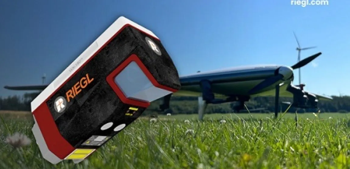
RIEGL VUX-180²⁴ – Lightweight and Versatile UAV LiDAR Sensor
RIEGL VUX-18024: lightweight and versatile UAV LiDAR Sensor for High-Speed Mapping
RIEGL VUX-180²⁴ Designed for high-speed survey missions and applications requiring optimum line and point distribution. This LiDAR sensor is suitable for power lines, railway lines, and pipeline inspections, topography in open pit mining, research of urban environments, archeology, and cultural heritage documentation, It is useful for mapping businesses such as Agriculture and Forestry.
Scanning speed up to 800 lines/second
Laser pulse repetition rate up to 2.4 MHz
Measuring speed up to 2,000,000 measurements/sec
Operating flight altitude up to 980 m / 3,250 ft
Field of View up to 75°
compact and lightweight (2.7 kg / 5.9 lbs)
Echo signal digitization, multi-target capability, online waveform processing, multi-time around processing
Can be mounted on unmanned platforms (UAV) and small manned aircraft
Mechanical and electrical interface for IMU/GNSS integration
Interfaces for up to 5 external cameras
SSD Memory
removable CFAST® memory card
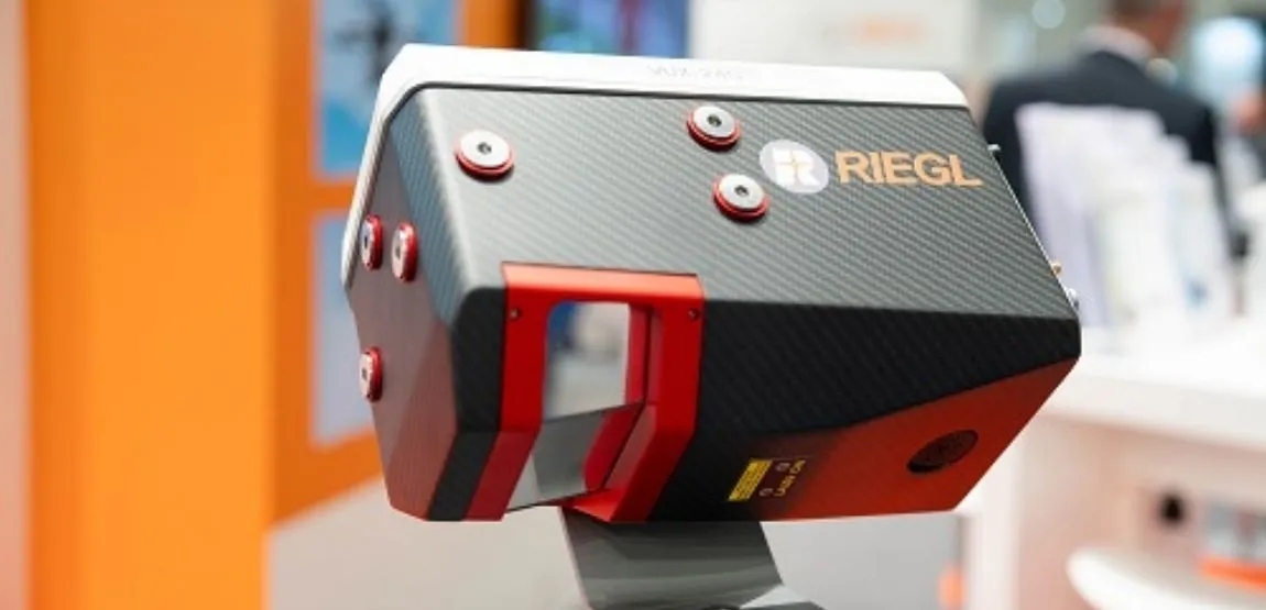
RIEGL VUX-240²⁴ – Enhanced Airborne LiDAR Sensor
RIEGL VUX-24024: now with enhanced performance for high-point density applications
RIEGL VUX-240²⁴ is an advanced lightweight airborne LiDAR sensor with high scanning performance. This LiDAR sensor is suitable for power lines, railway line and pipeline inspections, topography in open pit mining, research of urban environments, archeology and cultural heritage documentation,
It is useful for mapping businesses such as Agriculture and Forestry.
Laser pulse repetition rate up to 2.4 MHz
Measuring speed up to 2,000,000 measurements/sec
Scanning speed up to 600 lines/second
Flight altitude up to 1,430 m / 4,700 ft
Field of View up to 75°
perfectly linear and parallel scan lines
Echo signal digitization, multi-target capability, online waveform processing, multi-time processing
compact and lightweight
Can be mounted on unmanned platforms (UAVs), helicopters, gyros and other crewed aircraft
Mechanical and electrical interface for IMU/GNSS integration (optional)


