
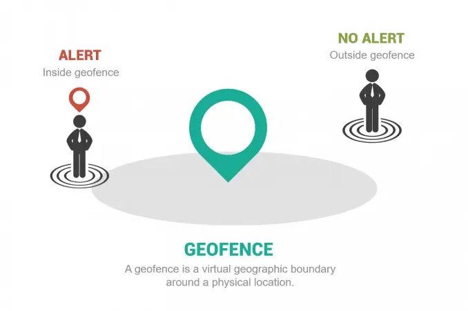
Geofencing is the usage of a virtual geographic boundary around a physical location. They allow users to detect when someone enters or leaves a location. By increasing geographic awareness with geofences, you can trigger events and notifications in real-time situations.
When you break up the word “geofence” into two separate parts, you get geo and fence.
GEO: Of course, geo is short for geography or location.
FENCE: Now, everyone can relate to the fence which is usually a boundary line such as between you and your neighbor.
When you put them together, you get a geographic boundary which is really a virtual geographic boundary line. And this can be a very powerful tool.
Because geofencing can detect when someone enters or leaves a location, it can send real-time alerts or notifications. For example, it can send a text message to a mobile phone and increases awareness.
Source: GISGeography


