
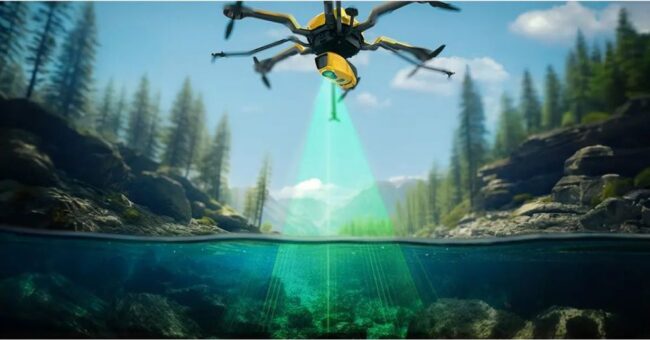
YellowScan, a prominent player and innovator in the field of LiDAR solutions for unmanned applications, has unveiled its latest bathymetric system, the YellowScan Navigator, during CES 2024
YellowScan has pioneered LiDAR mapping from drones since 2012, offering precise instruments that have improved many surveyors’ day-to-day operations. YellowScan constantly aims to develop outstanding products that address the evolving needs of the market. This year, YellowScan is excited to introduce the YellowScan Navigator, dedicated to fulfilling the crucial need of surveyors to map underwater topography, in rivers, ponds and coastal areas.
Learn more about Yellowscan Navigator


