GIS & Mapping
Your source for all things GIS and Mapping, including breaking news, updates, guides, tactics, tips, trends, equipments, softwares and more!

Step-by-Step: A Beginner’s Guide To Becoming…
By
Geographic Information Systems (GIS) is a rapidly growing field that allows us to collect, store, analyze, and visualize spatial data.…
2 min read
986 reads

What is a Map Scale?
By
Map scale is the reduction ratio we use when transferring a map or plan of a place from real life…
2 min read
3K reads
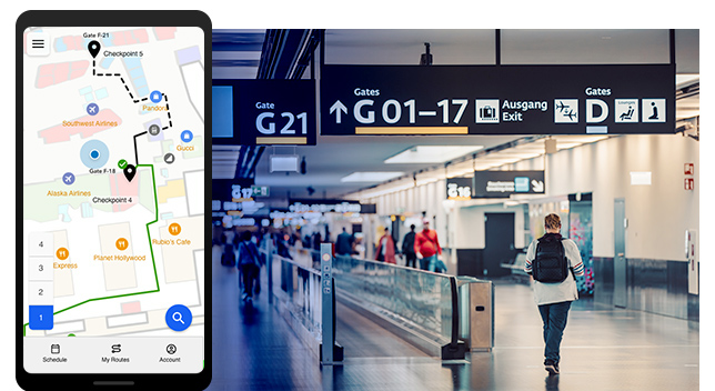
Esri’s New Indoor Positioning System “…
By
Esri announces the release of ArcGIS IPS, its new indoor positioning system that takes indoor GIS to the next level. Adding…
4 min read
2K reads
How To Use Geofencing In 7 Ways
By
Geofencing helps in determining geographic areas and boundaries. It is used for GPS and RFID (Radio Frequency Identification). The technology relies…
3 min read
703 reads

What is Datacubes in GIS?
By
Datacubes (or data cubes) are a form of data structure, where data are stored in multidimensional arrays (n-D arrays); the…
3 min read
621 reads

Esri Arcgis Pro Certified For 3D Stereo Visualizat…
By
Today, ArcGIS Pro from Esri is one of the most modern and advanced desktop GIS products and is used worldwide…
4 min read
2K reads

What Is A Spatial Database and Why Do We Need It?
By
What is a spatial database? A spatial database is a database that is enhanced to store and access spatial data…
2 min read
1K reads
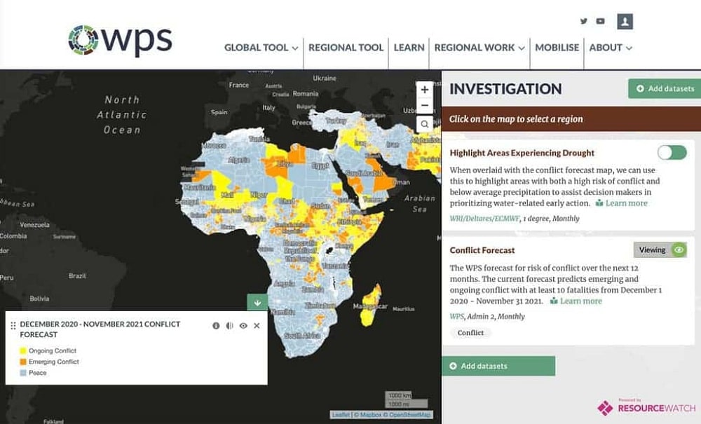
Preventing Violence With Geospatial Big Data
By
Violence, whether it is focused on individuals such as crime or at larger scales such as war, seems to be…
3 min read
2K reads
How Companies Use Geospatial Data?
By
The leaders of organizations rely on having the resources and intelligence that guide them toward making the right decisions at…
3 min read
773 reads
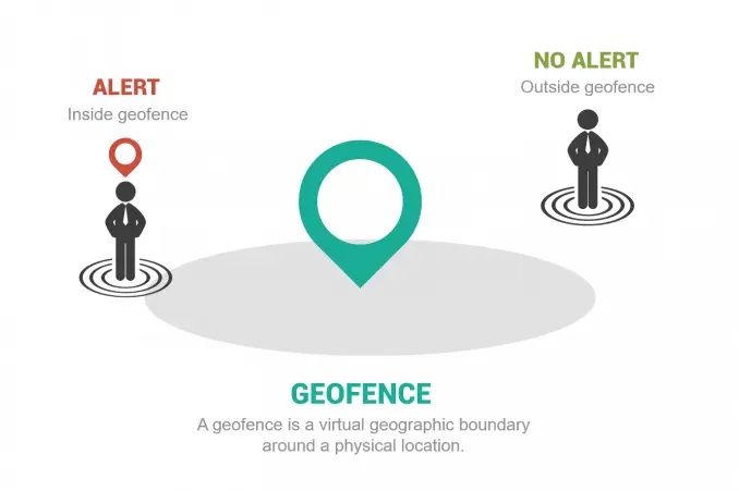
What is Geofencing?
By
Introduction to geofencing Geofencing is the usage of a virtual geographic boundary around a physical location. They allow users to…
< 1 min read
764 reads


