PhotogrammetryEmre AKDENİZ5 Steps, UAV Photogrametry Technique for BeginnersByEmre AKDENİZYou heard something about mapping with UAV / Drone, but you don’t know how and where to start? Then you’ve… 4 min read776 readsMarch 27, 2018
SurveyingEmre AKDENİZA New Reference System “Discrete Global Grid…ByEmre AKDENİZOne of the basic tasks of geodesy science is undoubtedly to create the model closest to the reality of the… 2 min read1K readsMarch 20, 2018
EVENTSEmre AKDENİZ2018 Istanbul FIG Congress – Part 2ByEmre AKDENİZNasıl Çalışır? FIG’s international congresses, organized every four years, and the annual Working Weeks’ programs are prepared and directed by… 2 min read671 readsMarch 9, 2018
LIDAREmre AKDENİZCrime Scene Investigation with 3D Laser DataByEmre AKDENİZToday, the position of laser scanners in the mapping sector is undeniable. But thanks to advancing technology and new techniques,… < 1 min read1K readsFebruary 27, 2018
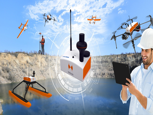
Surveying NewsEmre AKDENİZ“New DroneBox” Technology from HeliceoByEmre AKDENİZThis week we are studying Heliceo, a French technology company, and its products for drone technologies. What makes Heliceo different… < 1 min read1K readsFebruary 6, 2018
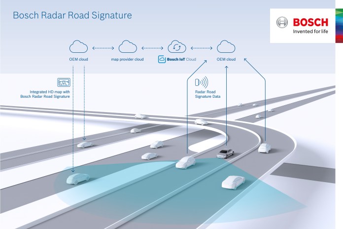
LIDAREmre AKDENİZAutonomous Driving with Bosch RadarByEmre AKDENİZNowadays we are used to seeing a lot of new news about the latest technology unmanned vehicles. One of the… < 1 min read895 readsJanuary 27, 2018
EVENTSEmre AKDENİZ2018 Istanbul FIG Congress “60 Years Longing…ByEmre AKDENİZThis year we will host a proud international organization as a country for all our colleagues. “FIG 2018”, also known… 3 min read831 readsJanuary 20, 2018
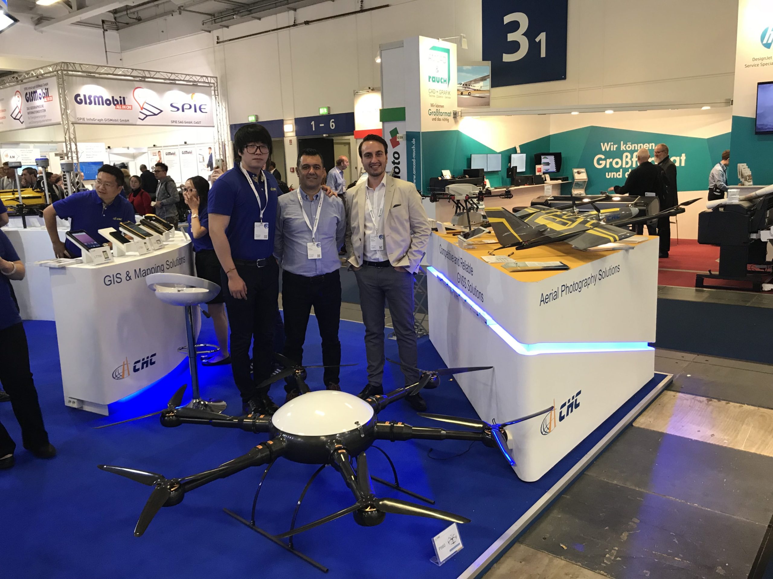
Surveying NewsEmre AKDENİZNew Year Surprises from CHCByEmre AKDENİZWe had a great conversation with Mr.Zhao, the founder of CHC. He also forwarded the signals of this year’s meeting… 3 min read726 readsJanuary 13, 2018
NewsEmre AKDENİZThe first Smart City Project is coming to life!ByEmre AKDENİZDigitization is a process, and while digitalization on a single issue has solved some of our problems, the classic issues… 2 min read989 readsJanuary 3, 2018
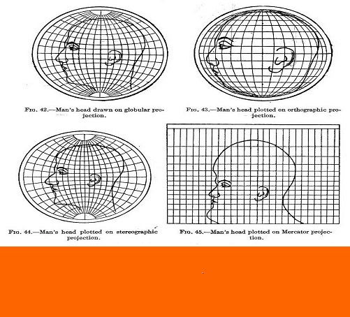
GIS & MappingEmre AKDENİZUnderstanding Map Projections in 5 StepsByEmre AKDENİZIt is difficult to understand how a very complex surface, such as the earth, is placed on a flat surface.… 3 min read1K readsDecember 17, 2017