News
You can find the latest breaking news about Surveying, Mapping, Lidar, and Photogrammetry for the geospatial community.

Simactive Introduced New Version with 3D Modeling
By
Photogrammetry software manufacturer SimActive Inc. Correlator3DTM software, a new 3D modeling module has been released, version 8.0. The module allows…
< 1 min read
640 reads

New DJI Phantom 4 RTK
By
Last week we were in Frankfurt to attend Intergeo 2018, the most important fair of the mapping industry. As a…
3 min read
1K reads
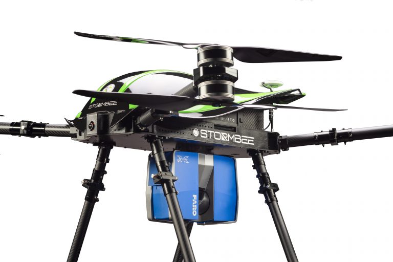
Stormbee & Faro Cooperation
By
FARO, one of the leading companies in 3D measurement and imaging sector, has integrated its products unmanned aerial vehicle manufacturer…
< 1 min read
1K reads

Introducing New “Leica AIBOT” with DJI…
By
Leica Geosystem unveils the latest ansız Leica Aibot ini, the latest unmanned aircraft UAV system integrated on DJI’s aerial platform…
< 1 min read
938 reads

The first Smart City Project is coming to life!
By
Digitization is a process, and while digitalization on a single issue has solved some of our problems, the classic issues…
2 min read
993 reads

Creating Road Projects Easier in Civil 3D 2018
By
We have all experienced more or less the package programs that the map units have to use during the construction…
2 min read
960 reads
Surveyinggroup & XYHT Content Partnership Agr…
By
As the Surveyinggroup family, we strive to keep our content quality on a scientific and technically rich basis. We signed…
< 1 min read
629 reads


