GIS & Mapping
Your source for all things GIS and Mapping, including breaking news, updates, guides, tactics, tips, trends, equipments, softwares and more!

Passive 3D stereo product family is growing: The n…
By
Schneider Digital‘s innovative, passive stereo monitor family has added a fourth model: with immediate effect, the 3D PluraView display is…
4 min read
468 reads
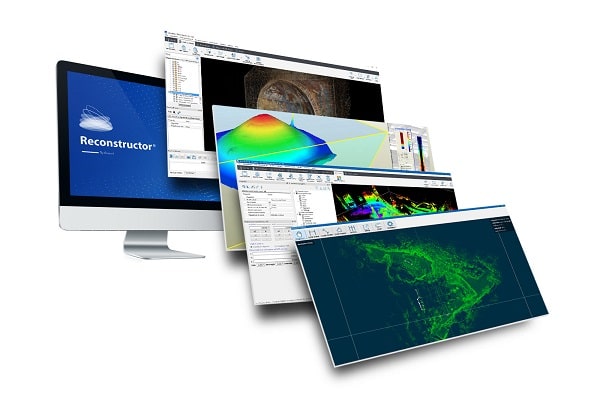
Process Large 3D Datasets from Mobile Mapping Syst…
By
The latest version of Gexcel’s lidar processing software makes a step forward into the processing of large datasets from various 3D…
3 min read
1K reads
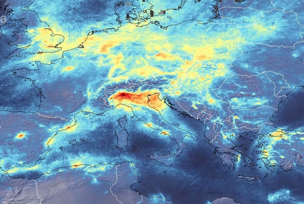
Satellite Images Shows, Air Pollution and CO2 Fall…
By
Levels of air pollutants and warming gases over some cities and regions are showing significant drops as coronavirus impacts work…
3 min read
1K reads
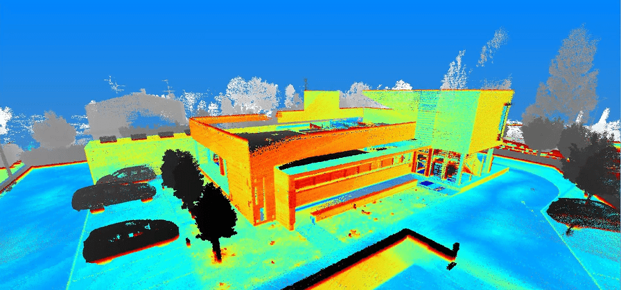
Mobile Mapping Helps Planning the Security of Publ…
By
Nowadays, the measures to take action in public events have gained more importance than in recent years. We could say…
3 min read
1K reads

Higher Resolution, More Spectral Bands
By
The designer, manufacturer, and operator of the largest constellation of Earth imaging satellites, Planet, is preparing to offer its highest-resolution…
2 min read
834 reads
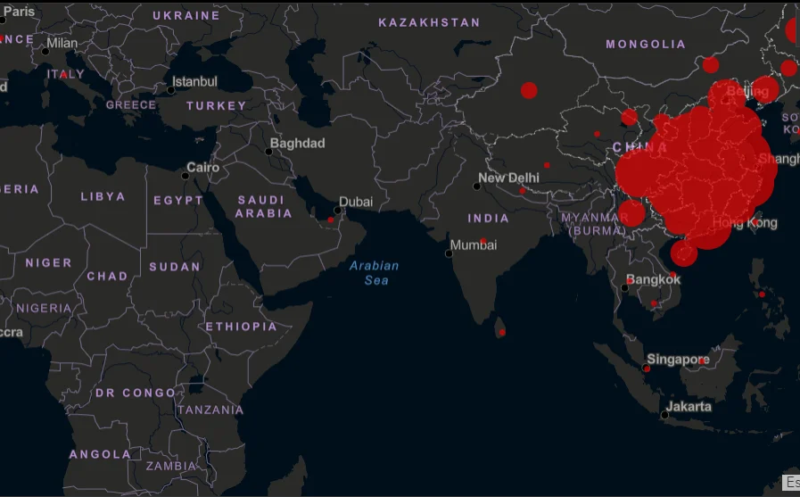
Corona Virus Live Map
By
The real-time map published by the US-based Johns Hopkins University, which works on Geographic Information Systems (GIS), you can follow…
< 1 min read
17K reads
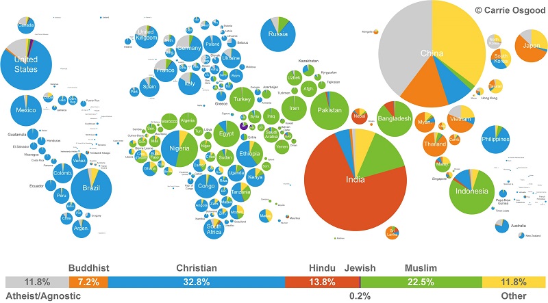
World Map of Religions
By
A picture says more than a thousand words, and that goes for this world map as well. This map, both…
3 min read
1K reads
Microsoft “Mixed Reality Maps”
By
Let’s say you are planning a vacation to Italy. You’re making a list of the things you want to do,…
2 min read
1K reads
5 Myths About Coding Web Maps
By
Myth #1: Coding web maps is exactly the same as coding any other web application and it’s hard. Coding web…
4 min read
1K reads

GIS and ArcGIS Pro Training From Scratch
By
“GIS and ArcGIS Pro Training From Scratch”, which we have prepared upon your intense demands, is now available for you…
< 1 min read
734 reads


