LIDAR
You can find the latest Lidar news, the best guides, and how-tos for the geospatial community.
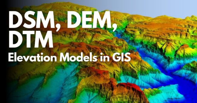
DSM, DEM, DTM: Elevation Models in GIS
By
This article discusses the basic digital elevation models DSM, DEM, and DTM required to depict various aspects of the Earth’s…
2 min read
4K reads

3D City Modelling of Istanbul
By
The Turkish city of Istanbul is developing a 3D city model mainly aimed at urban planning. The data sources used so far…
5 min read
1K reads

Crime Scene Investigation with 3D Laser Data
By
Today, the position of laser scanners in the mapping sector is undeniable. But thanks to advancing technology and new techniques,…
< 1 min read
1K reads
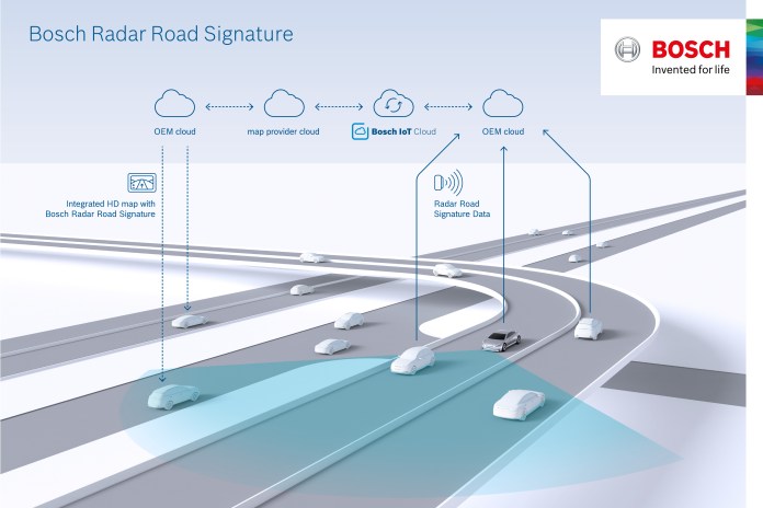
Autonomous Driving with Bosch Radar
By
Nowadays we are used to seeing a lot of new news about the latest technology unmanned vehicles. One of the…
< 1 min read
896 reads

Leica BLK 360 “More Than a Laser Scanner…
By
In almost every industry, we hear a lot about worlds equipped with 3D, BIM and virtual reality. Examples of spatial…
3 min read
1K reads

Bathymetry Drone “RIEGL Bathycopter”
By
One of the interesting products of INTERGEO 17 is that it has already made us curious. The new RIEGL Bathycopter!…
3 min read
2K reads


