In a groundbreaking development, researchers at the USGS Pacific and St. Petersburg Coastal and Marine Science Centers have introduced cutting edge technology that provides exceptionaly precise imagery of intricat el three-dimensional seafloor features.
SQUID-5, short for “Structure-from-motion Quantitative Underwater Imaging Device with 5 cameras,” stands at the forefront of underwater imaging technology. Employing Structure-from-motion (SfM) techniques, it combines digital imagery with precise global positioning (GPS) data to create highly detailed seafloor orthomosaics.
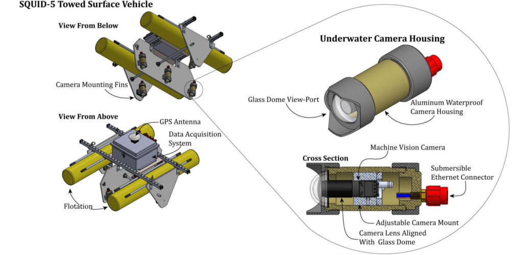
At the heart of SQUID-5’s capabilities is its utilization of the SfM technique, extracting three-dimensional insights from a series of two-dimensional images. Equipped with five strategically positioned cameras, SQUID-5 captures multiple perspectives simultaneously, all while recording their exact GPS coordinates. These data points are then synthesized into a comprehensive three-dimensional model, allowing for an unparalleled mapping o intricate seafloor details .
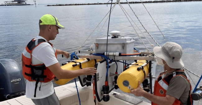
Originally designed for mapping nearshore coral reefs, SQUID-5 excels in environments characterized by complex seabed surfaces in shallow, clear waters. Its successful trial at Dollar Point, a bedrock reef in Lake Tahoe, California, during the pandemic, paved the way forsubsequent deployments. In 2021 and 2022, the system was employed for USGS coral reef scientific mapping in the US Florida Keys.
The detailed 3D models produced by SQUID-5 offer a window into the evolution of complex underwater habitats over time. These invaluable insights serve scientists and resource managers alike, fueling various research and restoration endeavors, including coral reef restoration projects in Florida and beyond.
SQUID-5’s ability to map extensive coral reef areas with millimeter precision and precise geo-location enables the tracking of coral growth and/or loss on a spatial and temporal scale previously beyond reach. This data is pivotal in understanding the challenges faced by coral reefs, from rising ocean temperatures to acidification, coastal erosion, and sea-level rise.
—Gerry Hatcher, Ocean Engineer at Pacific Coastal and Marine science Center’s Marine Facility and the lead engineer of SQUID5
Featured here is a bathymetric digital elevation model (DEM) of Eastern Dry Rocks coral reef, Florida, 2021 . This DEM, created from underwater images gathered using the SQUID-5 camera system, provides a vivid illustration of the system’s capabilities in action.