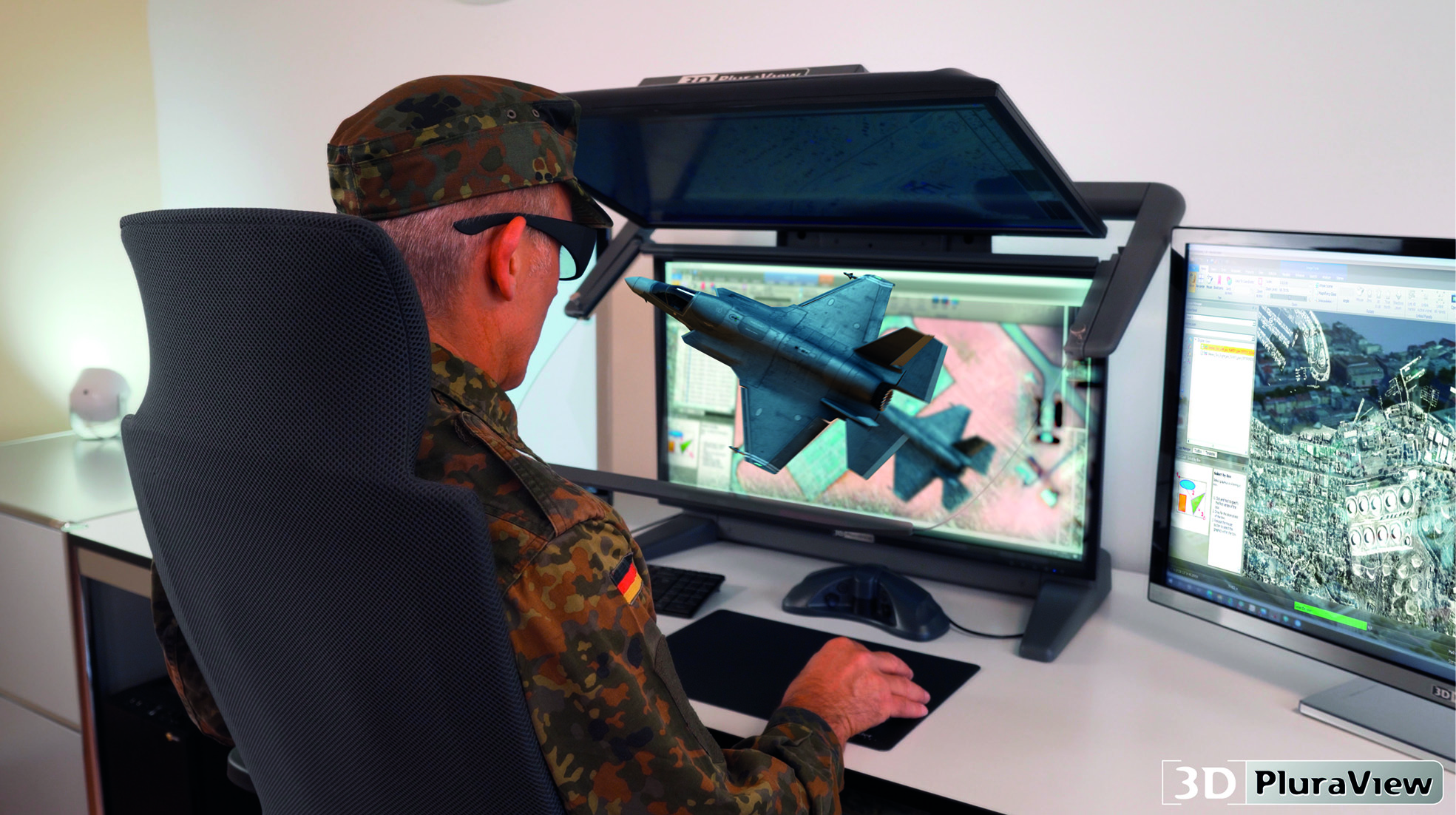
PhotogrammetryNursinem Handan ŞAHANStereoscopic Desktop Monitors for Military UseByNursinem Handan ŞAHANStereoscopic desktop monitors for military use – shielded and zoned according to NATO standards Today, armed forces worldwide use digital,… 4 min read397 readsNovember 24, 2021
EVENTSNews DeskGEO Business 2021, 24-25 November at ExCeL LondonByNews DeskGEO Business, the UK’s largest geospatial event, has revealed the much-anticipated speaker line up for this year’s show, which takes… 4 min read411 readsNovember 19, 2021
Aerial MappingNursinem Handan ŞAHANSkyGrid: Autonomous Remote UAV Operations SolutionByNursinem Handan ŞAHANSkyGrid, a Boeing, SparkCognition company, announced today that it has released a new autonomous remote UAV operations capability to allow… 2 min read661 readsOctober 8, 2021
Satellite ImageryNursinem Handan ŞAHANNASA Measuring The Noise Footprint Of Electric Air…ByNursinem Handan ŞAHANJoby Aviation and NASA are kicking off a two-week test campaign to study the acoustic signature of Joby’s all-electric passenger… 2 min read1K readsOctober 1, 2021
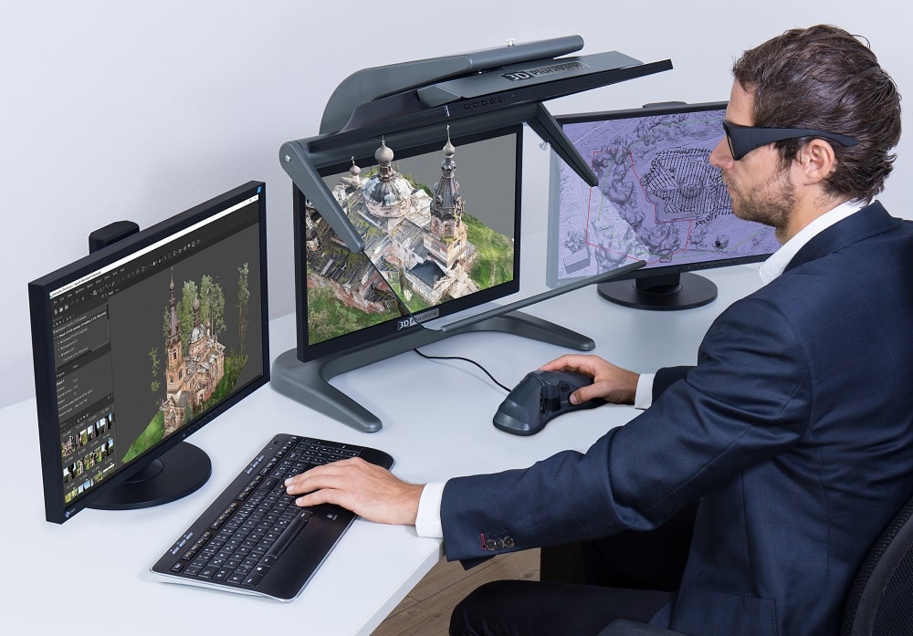
PhotogrammetryNursinem Handan ŞAHANAgisoft Metashape Pro And 3D Pluraview Monitors En…ByNursinem Handan ŞAHANWhere classic surveying reaches its limits, the 3D photogrammetry application Agisoft Metashape Pro is being used, often in a combination… 6 min read564 readsAugust 12, 2021
NewsNursinem Handan ŞAHANPix4D Celebrates 10 Year Anniversary And Launches…ByNursinem Handan ŞAHANPix4D is celebrating its 10 year anniversary. The company is unveiling a new logo to commemorate the event. Pix4D emerged… 2 min read497 readsJune 9, 2021
GIS & MappingNursinem Handan ŞAHANHow Companies Use Geospatial Data?ByNursinem Handan ŞAHANThe leaders of organizations rely on having the resources and intelligence that guide them toward making the right decisions at… 3 min read550 readsApril 14, 2021
Lidar NewsNews DeskCHC Navigation introduces the AlphaAir 450 LiDAR S…ByNews DeskThe lightest, advanced accurate, and cost-effective UAV LiDAR system in its class. CHC Navigation (CHCNAV) announced the release of the… 2 min read539 readsApril 5, 2021
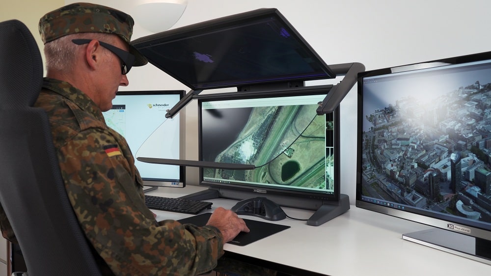
PhotogrammetryNursinem Handan ŞAHANStereoscopic Display Technologies For Military App…ByNursinem Handan ŞAHANAs a professional IT solutions provider, Schneider Digital is specialized in the development and manufacturing of stereoscopic display systems, as… 5 min read733 readsMarch 8, 2021
NewsNews Desk7 Benefits of Using Remote Sensing & GIS in A…ByNews DeskRemote sensing and Geographic Information System (GIS) technologies are commonly used for real-time analysis and forecasts of weather, floods, and… 3 min read3K readsFebruary 17, 2021